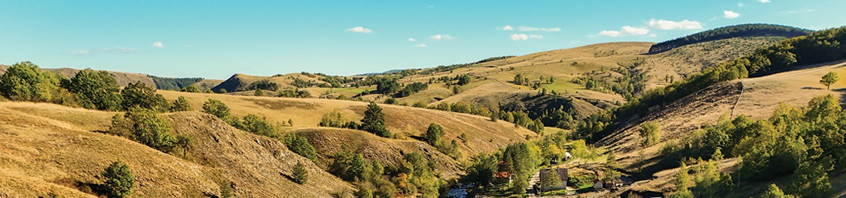
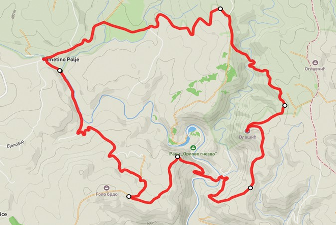
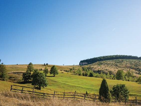
One of the most attractive trails on the slopes of Maljen, it starts from the confluence of the Bela and Crna Kamenica rivers. It leads along an asphalt road to the hamlet of Mitrovica, to Golog Brdo, 710 meters above sea level. It continues along the road, across pastures to the Klik viewpoint, located above the Orlovo gnezdo ranch, from where the view opens up to the meanders of the Kamenica River, vast pastures, then local households, dozens of hills that intertwine one over the other, covered with grass, stones, small groves, white birches, herds of cows and sheep, simply tempting the visitor to reach every elevation. The most beautiful photographs of Tometino Polje were taken from this area.
From there we descend to 525 m above sea level, crossing the Kozlica River over an improvised bridge. Then we climb the ridge, and from there, along a 1.5 km long trail, we reach the peak of Vlašić (716 m above sea level), which is in our sight the whole time because it dominates the surroundings. From the trail, we can see Kamenica, Divčibare, Ravna Gora, Subjel, Zajčica, Maljen – the vast expanses of this area because it is the highest peak in the vicinity. The view of two mountain rivers and their winding courses is not seen every day. Next, we head to the viewpoint in the hamlet of Milinkovići, and then to the center of Tometino Polje. The trail is marked with standardized hiking markings, however, there are segments where the markings are faded and difficult to see, so it is necessary to download the .gpx file.
Marking and description of the trail PD "Rujno" Užice