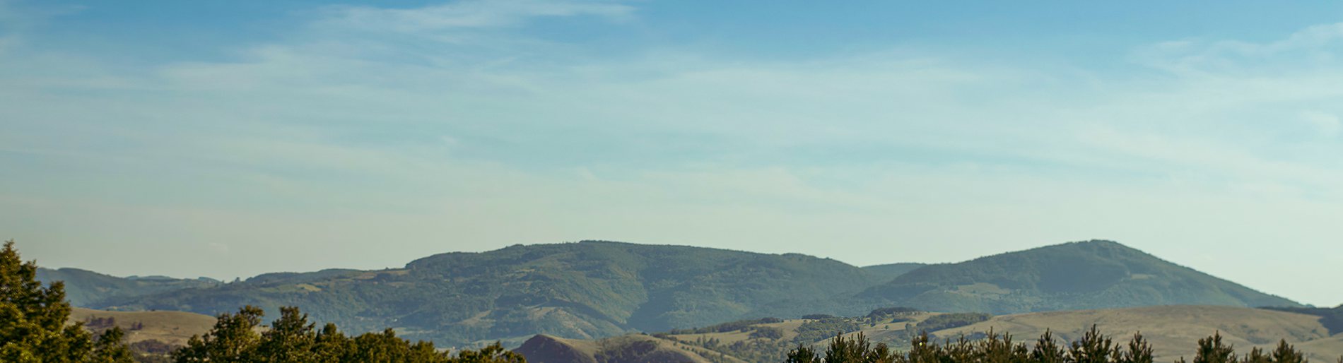
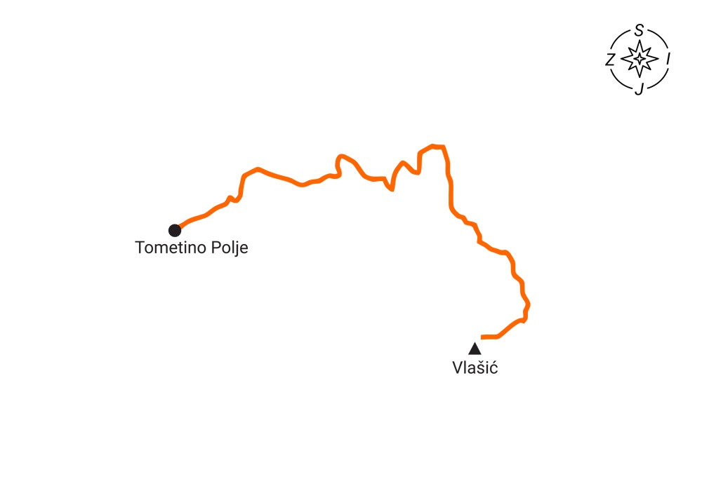
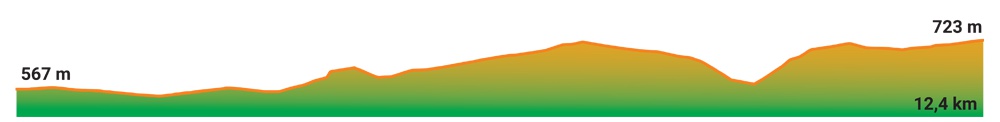
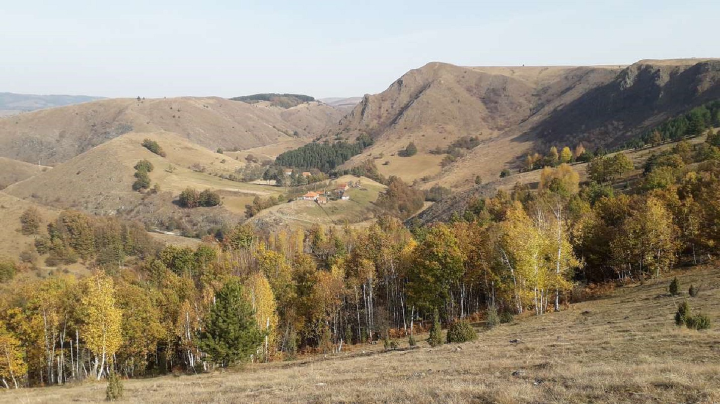
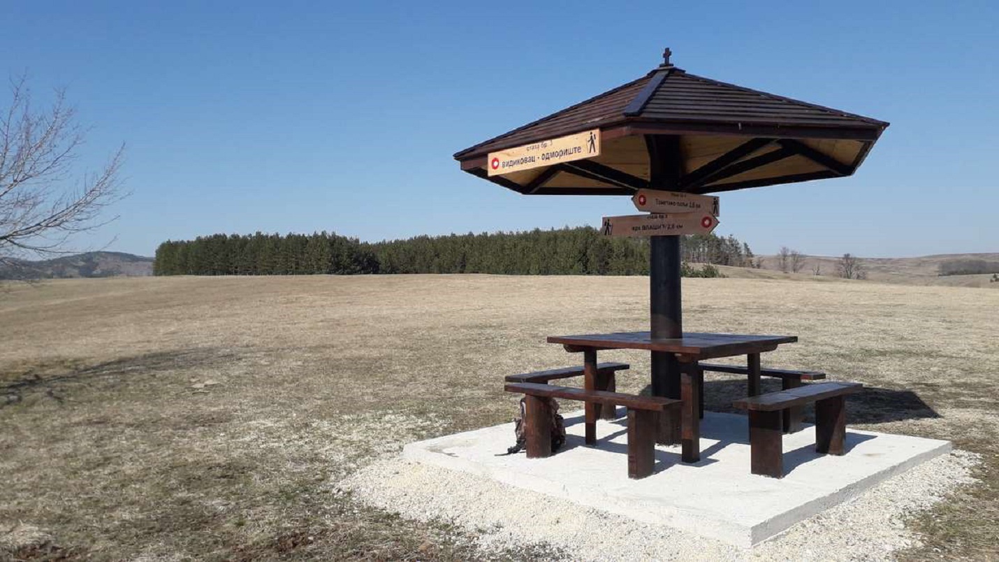
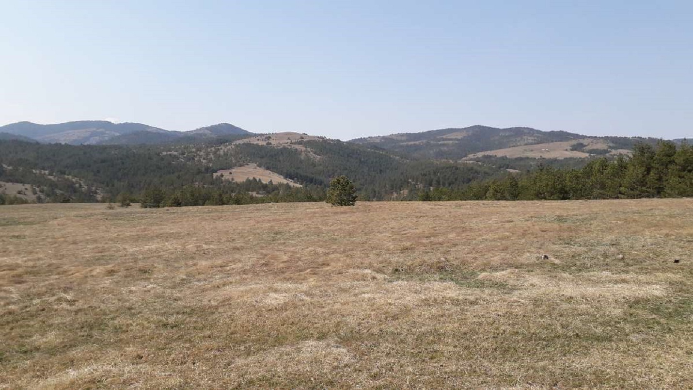
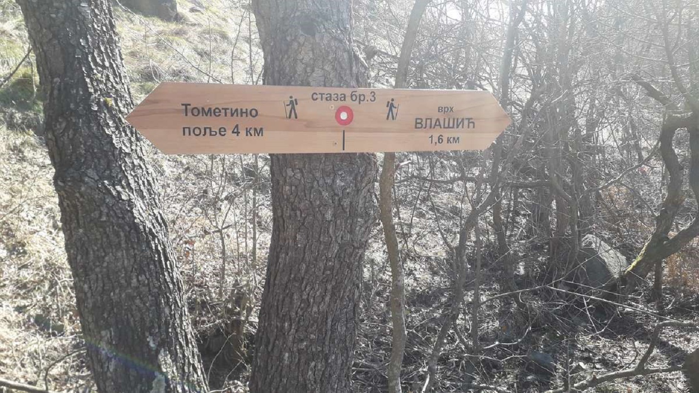
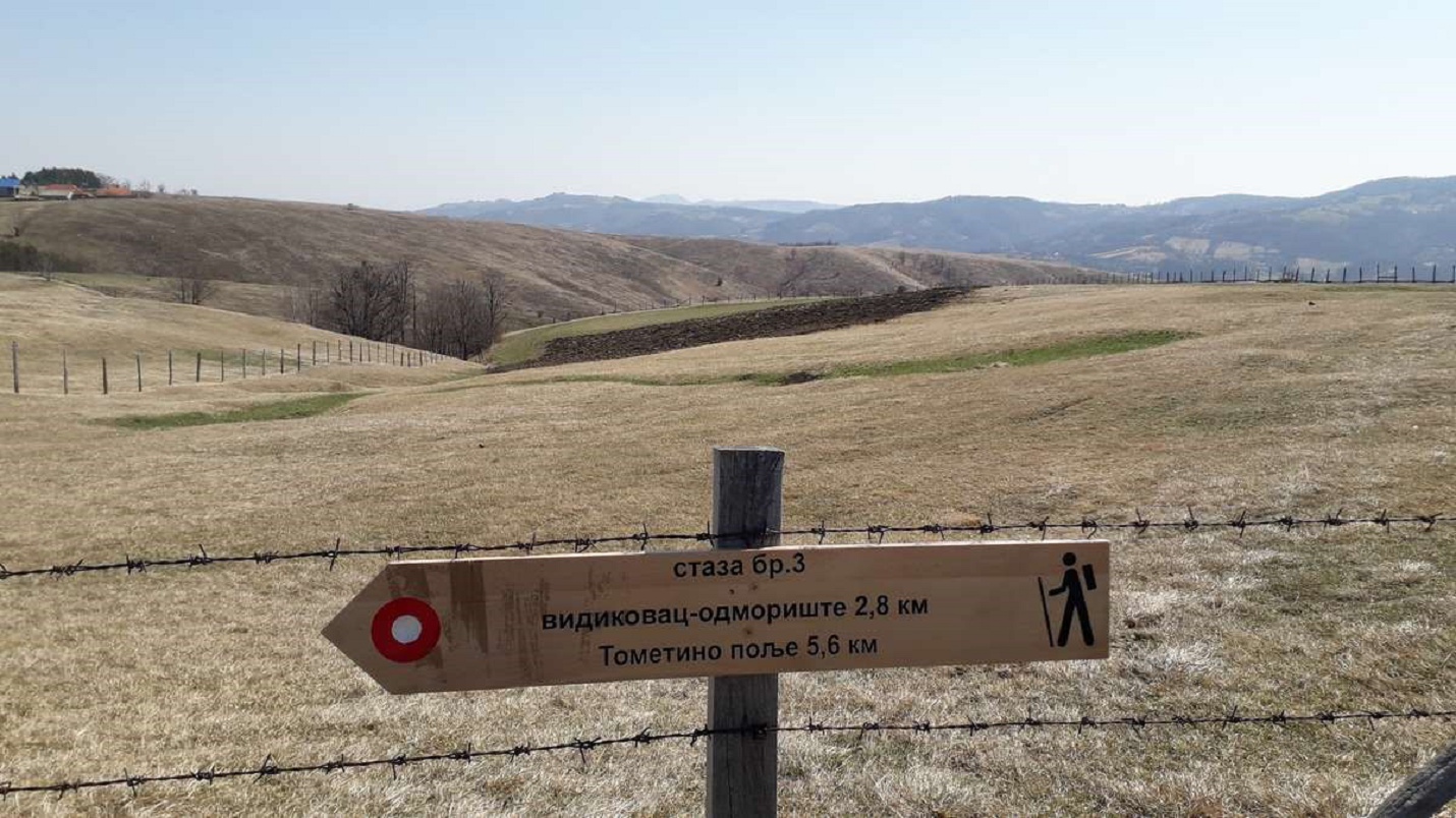
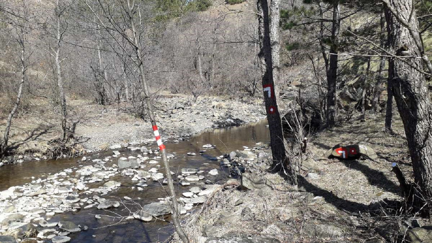
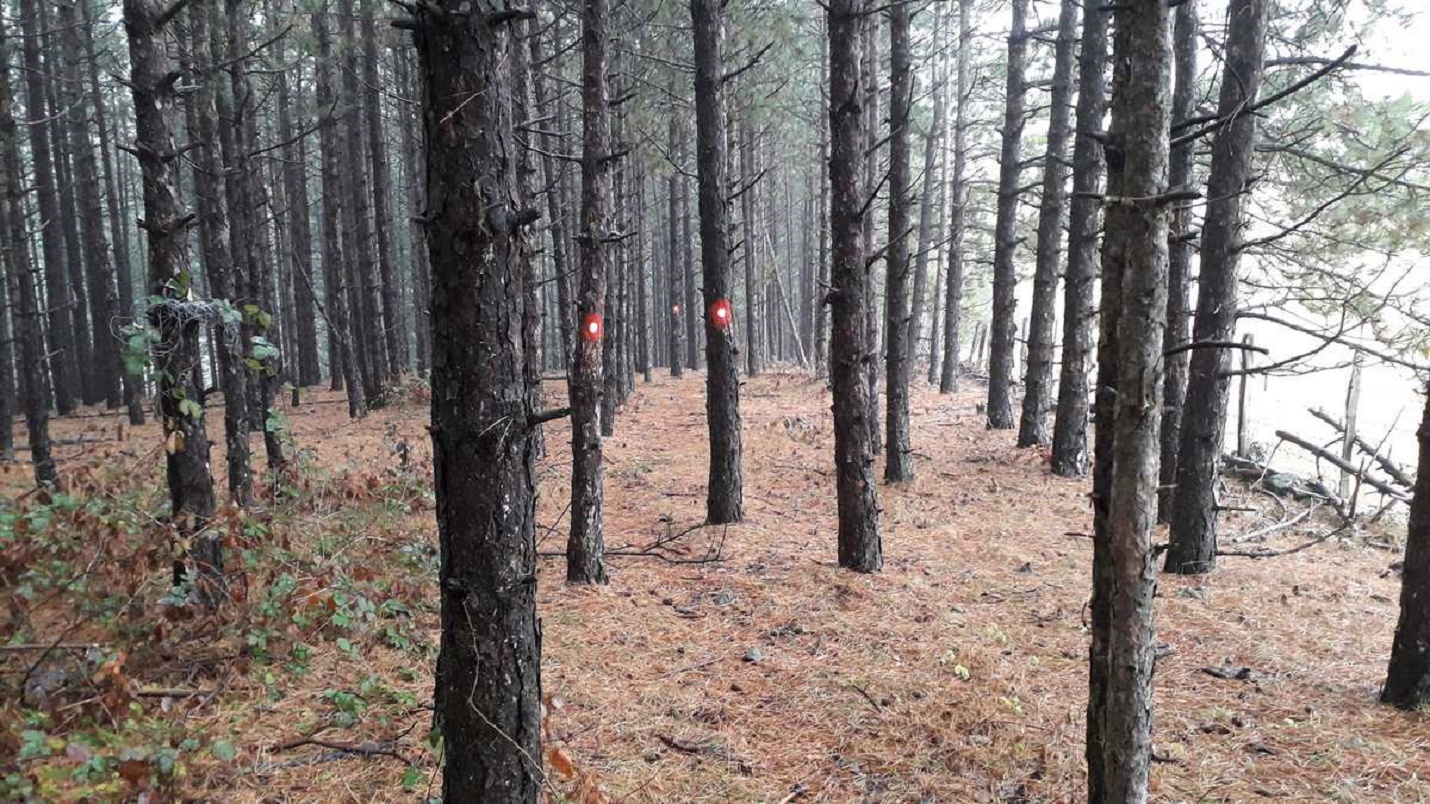
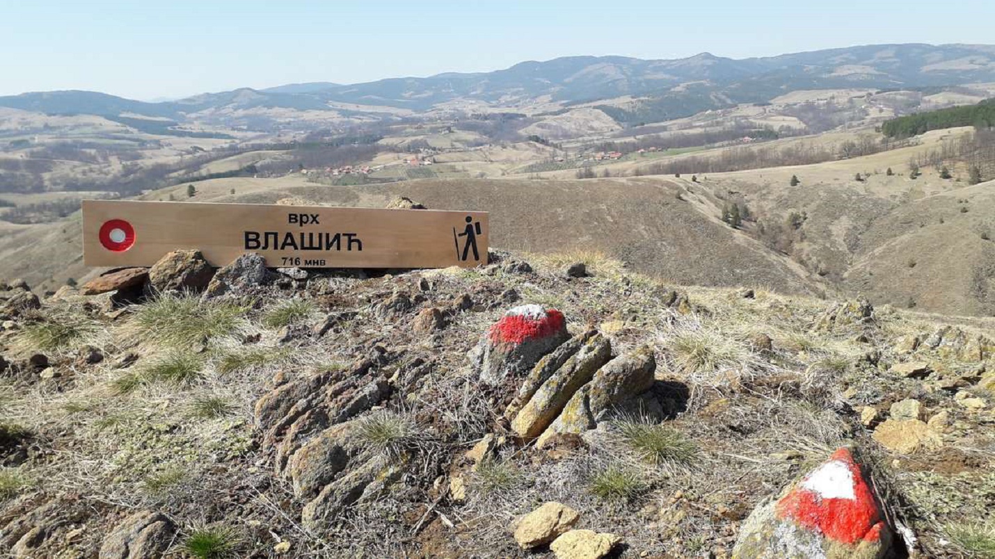
The trail is 12.4 km long, with 130 m of ascent and 260 m of descent.The start of the trail is near the Elementary School and the PPD Maljen mountain lodge.It is 6.2 km long with 130 m of ascent and 260 m of descent.Trail no. 3 leads at the intersection to the right (trails 1 and 2 lead to the left) and the asphalt road leads to the bridge on the river Bela Kamenica, at the signpost turn right (the road continues straight to path 1a) and in about 2.6 km from the start,we reach the lookout point of the rest area where there is a beautiful view of Tometino polje, top of Vlašić, Subjel, Velika Zajčica, the Valjevo mountains… We continue towards the hamlet of Milinkovići, from where we descend to the crossing of the Kozlica river and then follow the ascent to top of Vlašić 716m above sea level, whichit is in our sight all the time because it dominates the surroundings.From the trail, you can see Kamenica, Divčibare, the vast expanses of this region because it is the highest peak in the vicinity.The view of two mountain rivers and their winding courses is not seen every day.We continue through pine and birch forests, along a stony path overgrown with thick clumps of grass, through soft meadow lawns.An area of unusual beauty that leaves no one indifferent and awakens the desire to return.This beauty cannot be seen either from the first or from the second road… You will take away a lot of positive energy and wonderful impressions from these heights, mesmerized by the surroundings.The return is on the same trail we came on, and there is also the possibility to continue, also on the marked trail no. 4, which leads across the Bela Kamenica river, the Klik viewpoint (with a view of the meanders of Bela Kamenica and the Orlovo gnezdo locality) and then over Golo brdo and the hamletMitrovići, to the center of Tometino Polje.
Marking and description of the trail by PD "Rujno" Užice